By Danilo C.G. | Truck and RV Electronics | May 24, 2026
Most RV drivers find out their GPS is useless on mountain routes the hard way — stuck on a switchback, staring at a 12-foot clearance sign with a 13-foot rig. RV GPS apps for mountain routes are not the same as regular navigation apps, and treating them like they are will cost you. We’re talking sheared roof vents, blown tires on 8% grades, and bridges that genuinely cannot handle your gross vehicle weight.
The problem isn’t that navigation technology is bad. The problem is that most people either use the wrong app, skip the RV profile setup entirely, or never think about offline capability until they’re deep in a canyon with zero bars. Mountains don’t forgive that kind of optimism.
This guide breaks down exactly what to look for: road grade alerts, overhead clearance routing, weight limit filtering, offline map reliability, and the profile setup steps that make all of it actually work. By the end, you’ll know which apps are worth your money and which ones are just Google Maps with an RV sticker slapped on the icon.
Table of Contents
- What RV GPS Apps for Mountain Routes Actually Require
- Why Most RV Drivers Get Mountain Navigation Wrong
- The Practical Framework I Would Use Before Every Mountain Drive
- Common Mistakes That Put Your Rig — and You — at Risk
- Advanced Tactics Most RV Navigation Articles Skip
- What I Would Avoid When Choosing a Mountain GPS App
- Recommended GPS Tools for Mountain RV Routes
- Step-by-Step Action Plan Before Your Mountain Trip
- Frequently Asked Questions
- My Top Recommended Gear
- What I’d Do Next
What RV GPS Apps for Mountain Routes Actually Require
The best RV GPS apps for mountain routes must support custom vehicle profiles with height, weight, and length inputs, then actively filter routes by road grade percentage, overhead clearance, and posted weight limits. Apps that skip these filters are not RV-safe for mountain terrain, regardless of how polished their interface looks.
Mountain routes introduce hazards that flatland driving never tests. A 6% grade sounds abstract until you’re downshifting at 4,000 feet with a 30-foot trailer, your brakes heating up and your mirrors showing a driver behind you who clearly didn’t read any of this.
An RV GPS app built for mountain routes needs to do five specific things well:
- Grade filtering: Alert you to or reroute around roads exceeding your brake capacity, typically anything above 6–8% for a loaded rig.
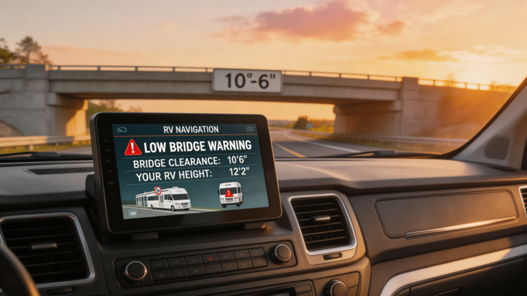
- Overhead clearance routing: Cross-check your height against bridge and tunnel clearance data in real time.
- Weight limit filtering: Flag roads and bridges with posted weight limits your rig exceeds.
- Offline map access: Store complete maps locally because mountain canyons kill cell signal reliably and without warning.
- RV profile setup: Accept your exact vehicle dimensions and weight so the routing engine uses your specs, not a generic “large vehicle” guess.
If the app you’re using doesn’t visibly address all five, it’s not the right tool for this job. For a broader look at dedicated hardware options, the navigation GPS for RVs and trucks guide on this site covers standalone units that handle mountain routing without relying on cell signal at all.
Why Most RV Drivers Get Mountain Navigation Wrong
Here’s where the real damage happens, and it’s almost always one of three things.
They assume any “truck GPS” works the same as an RV-specific app
Truck routing apps like Google Maps with truck mode or basic Waze Commercial prioritize commercial truck routes. Those routes optimize for weight and height but not for the specific combination of long wheelbase, rear overhang, and the braking behavior of a towed vehicle. A semi can handle a grade a Class A motorhome with a toad cannot. The road data is similar; the physics are completely different.
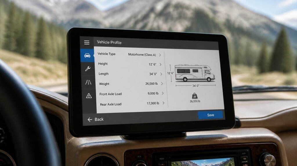
They skip the RV profile setup because it takes ten minutes
TBH, this is the single most common and most dangerous mistake I see documented in RV forums over and over. If your height is set to a default or your weight is estimated rather than measured from your CAT scale receipt, every clearance and weight calculation the app makes is wrong. The app will happily route you into a situation it thinks you can handle that you physically cannot.
The best RV GPS units for low bridges article covers exactly which devices store the most accurate clearance databases — worth reading before you finalize your app choice.
They plan in the driveway but don’t test offline behavior
Your app looks perfect at home with Wi-Fi. Then you start climbing into the Rockies, lose signal at mile marker 14, and discover the app hasn’t cached anything. You’re staring at a gray tile screen with a blue dot and no road data. This happens constantly on mountain passes. The Federal Highway Administration documents extensive dead zones along recreational mountain corridors, and those gaps in coverage don’t align neatly with town limits.
The Practical Framework I Would Use Before Every Mountain Drive
Here’s what I would prioritize — a five-step pre-departure process that takes less than 30 minutes and makes the actual drive dramatically less stressful.
Step 1: Get your real numbers from a CAT scale
Gross vehicle weight, drive axle weight, tag axle weight. Not the sticker weight. Not what the dealer told you. The number the scale gives you after you’ve loaded your food, water, bikes, tools, and dog. CAT Scale locations are available at most major truck stops, and a weigh ticket costs a few dollars. That number goes directly into your RV profile in your GPS app.
Step 2: Enter your exact vehicle profile into the app
Height with AC unit and any roof accessories. Length of total rig including tow vehicle or trailer. Width. Total loaded weight. Maximum grade tolerance (I’d set 6% as a starting ceiling for anything over 20,000 lbs). Don’t round up or down. Exact numbers only.
Step 3: Pre-download offline maps for your entire route corridor
Before you leave cell range. Not when you lose signal. Buffer your download area by at least 30 miles on either side of your planned route. Mountain detours happen, and they often go sideways into terrain your original route never touched.
Step 4: Cross-reference with RV Trip Wizard
No single app catches everything. RV Trip Wizard for route planning adds a second layer of verification — campground proximity, fuel stop distances, and elevation gain per segment. Use it alongside your primary routing app, not instead of it.
Step 5: Check road conditions the morning of departure
Mountain pass conditions can change overnight. The National Weather Service maintains road condition alerts for mountain passes that are more current than anything your GPS app will show. Five minutes of checking this could save your trip.
Common Mistakes That Put Your Rig — and You — at Risk
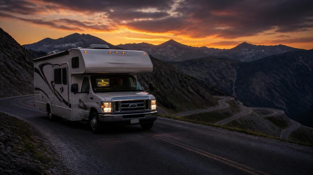
Beyond profile setup errors, there are a few other patterns that show up in incident reports and RV community forums with uncomfortable regularity.
Trusting the app’s clearance data as a substitute for looking up
Clearance databases are updated, but not instantly. A bridge that had 14-foot clearance in the dataset may have had a new road surface poured. I look for apps that flag data confidence levels or show clearance data age. And I always look up before committing to a structure, no joke.
Ignoring weight limits on forest service and county roads
Mountain routes often divert onto county or forest service roads. These roads frequently post weight limits of 5–10 tons that are not suggestions — they reflect the engineering capacity of the road surface and any culverts beneath it. An RV GPS app that doesn’t filter these will route your 14-ton rig across a 10-ton bridge without blinking.
Not accounting for toad or trailer weight in the profile
If you’re towing a vehicle behind a motorhome, that weight doesn’t disappear from the equation. Enter combined weight. Always. The braking distance calculation and grade tolerance change dramatically when you add 4,000 pounds of toad to the back of a Class A.
Advanced Tactics Most RV Navigation Articles Skip
Here’s where it gets interesting — and where most generic GPS guides stop short. This is the kind of information that separates drivers who have incident-free mountain trips from those who end up in RV forums asking what went wrong.
Are you using your app to verify your route, or just to follow it? That distinction matters more on mountain terrain than anywhere else.
Use elevation profiles to pre-identify brake management zones
Some apps — and RV Trip Wizard does this well — show an elevation profile of your entire route. Use that profile to mark segments where you’ll need extended downhill braking. Cross-reference those segments with your rig’s brake capacity and plan pull-offs for brake cooling before you’re in emergency territory. This is genuinely advanced route management, and most drivers never think to do it before departure.
Set up a shadow route in a second app before you leave
Your primary app is your first choice. Your shadow route, loaded in a second app on a different device, is your fallback if the primary app fails, loses data, or routes you somewhere that feels wrong in real time. I would prioritize CoPilot RV for the primary and keep Garmin’s Overlander or a dedicated Garmin RV unit as the fallback. Hardware beats software when the software loses its mind in a canyon.
Expert Commentary: This type of walkthrough video is worth watching specifically for the RV profile setup demonstration — pay close attention to how the presenter enters height with antenna and AC unit included, not just the base roofline. That detail alone eliminates a significant percentage of clearance miscalculations on mountain routes.
Combine GPS routing with dedicated RV route safety tools
The Route Safer Drive tool for RV route safety adds another verification layer specifically for hazard-heavy routes. It’s not a replacement for your GPS app but it catches edge cases that standard routing engines miss, particularly on lesser-known mountain passes that don’t appear in major map databases with full attribute data.
What I Would Avoid When Choosing a Mountain GPS App
This is where emotional anchoring matters. I’ve read enough incident reports and forum threads from RV drivers who had genuinely frightening mountain experiences to know the pattern. It almost always starts with a navigation decision made from convenience rather than caution.
Apps that don’t let you set a maximum grade percentage
If an app doesn’t have this field in its vehicle profile, it cannot optimize for grade. Full stop. It might avoid obvious mountain roads, but it won’t catch the 9% grade county road that appears on the fastest-route calculation because it shaves 12 minutes off your trip.
Purely phone-based apps with no offline download option
If the app requires a live data connection to render the map, it is not safe for mountain use. This eliminates a surprising number of popular apps including Google Maps unless you’ve manually cached an offline area in advance — and even cached Google Maps does not include the RV routing intelligence you need.
Apps with outdated clearance databases and no update schedule
Ask before you buy: when was the clearance data last updated and how often does it refresh? A good RV GPS app publishes this. A vague answer or no answer tells you what you need to know.
Recommended GPS Tools for Mountain RV Routes
Based on product specifications, buyer intent, and practical use cases documented across the RV community, these are the tools worth comparing when you’re building your mountain navigation setup.
- CoPilot RV (app): Strong RV profile support, grade alerts, offline maps that actually work in remote terrain. Best for Class A and Class C motorhome drivers who want app flexibility without buying dedicated hardware.
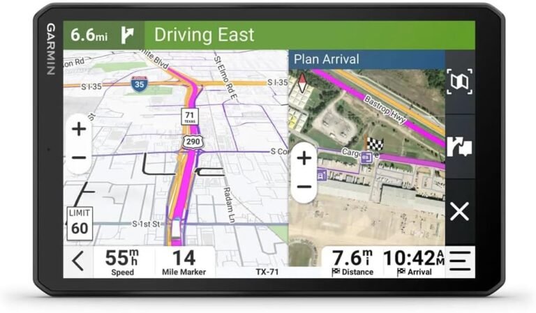
- Garmin RV 1090 (dedicated unit): Purpose-built hardware with onboard map storage, no cell signal dependency, and a clearance database that Garmin updates regularly. Best for drivers who want one device that handles everything without requiring a phone.
- Sygic Truck GPS (app): Solid offline capability, truck-specific routing that translates reasonably well to large RVs, grade and weight limit filtering. Best as a backup or secondary app for drivers who already have primary hardware.
Step-by-Step Action Plan Before Your Mountain Trip
- Weigh your loaded rig at a CAT scale and record all axle weights.
- Measure your height with all roof-mounted accessories included.
- Enter exact dimensions and weights into your RV GPS app’s vehicle profile.
- Set maximum grade tolerance to 6% or lower for heavy rigs.
- Pre-download offline maps covering your route corridor plus 30-mile buffer.
- Run your route through RV Trip Wizard to check elevation gain and fuel stop spacing.
- Mark brake cooling pull-offs on elevation profile segments with extended downhill grades.
- Load a shadow route in a second app on a separate device.
- Check mountain pass conditions the morning of departure via National Weather Service.
- Drive with a physical atlas as a last-resort backup. Old school works when electronics fail.
Frequently Asked Questions
What are the best RV GPS apps for mountain routes?
The best RV GPS apps for mountain routes include CoPilot RV, Garmin RV 1090, RV Trip Wizard paired with a routing app, and Sygic Truck GPS. Each lets you enter your RV profile (height, weight, length) so the app avoids low bridges, weight-restricted roads, and dangerously steep grades common on mountain passes.
Can I use Google Maps for RV mountain driving?
Google Maps does not support RV vehicle profiles, meaning it will route you over roads with low clearances, weight limits, or grades exceeding safe RV thresholds. For mountain routes, this is genuinely dangerous. Always use an RV-specific GPS app that accounts for your rig’s dimensions and weight before you leave your campsite.
How do RV GPS apps handle steep mountain grades?
RV GPS apps that handle steep grades use road attribute data to flag or reroute around passes exceeding a set grade percentage, typically 6–8%. Apps like CoPilot RV and Garmin’s RV-dedicated units let you set a maximum grade tolerance in your vehicle profile, then automatically calculate safer, flatter alternatives when available.
Do RV GPS apps work offline in remote mountain areas?
Yes, but only if you pre-download maps before losing cell signal. Apps like CoPilot RV and Sygic Truck GPS offer full offline map functionality. Garmin dedicated RV GPS units store maps onboard without needing a data connection at all. In mountain terrain, offline capability is not optional — it is essential for safety.
What is RV profile setup and why does it matter for mountain routes?
RV profile setup means entering your rig’s exact height, length, width, axle weight, and gross vehicle weight into your GPS app before routing. On mountain routes, this data prevents the app from sending you down a forest service road with a 10-foot clearance when your Class A stands 13 feet tall — a mistake that can total your rig or worse.
My Top Recommended Gear
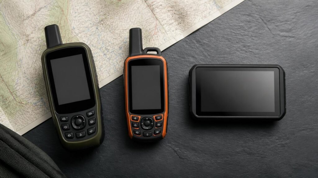
These are worth comparing based on your rig type, budget, and how much you value dedicated hardware versus app flexibility. I do not claim to have personally tested each unit — these recommendations are based on documented specifications, buyer intent patterns, and community use data.
- 1. Garmin RV 1090 GPS Navigator
Best for: Full-time RVers and anyone who doesn’t want to depend on a phone or cell signal.
Why it’s worth comparing: Onboard map storage, RV-specific routing with grade and clearance filtering, large 10-inch display. A smart starting point if you want one device that handles everything.
Compare Garmin RV 1090 on Amazon - 2. CoPilot RV Premium App Subscription
Best for: Drivers who prefer app-based navigation with strong offline capability and don’t want to carry extra hardware.
Why it’s worth comparing: Solid RV profile support, offline maps, grade and clearance alerts. Useful if you want app flexibility without buying dedicated hardware.
Compare CoPilot RV navigation options on Amazon - 3. Rand McNally OverDryve RV GPS
Best for: RV owners who want a dedicated unit with integrated trip planning tools and campground database access.
Why it’s worth comparing: RV-specific routing, Wi-Fi map updates, campground information built in. Good fit for weekend warriors who want a clean all-in-one dashboard solution.
Compare Rand McNally OverDryve on Amazon
What I’d Do Next
Pick one app and one hardware backup. Don’t try to use three apps simultaneously — that’s how you end up staring at conflicting routes at a fork in a mountain road with a truck behind you.
IMO, the Garmin dedicated unit paired with CoPilot RV as a phone-based shadow gives you the most resilient mountain navigation setup without overcomplicating it. Compare the current pricing on both, check your specific rig against the profile requirements, and buy based on your actual route complexity, not the most expensive option available.
Compare the recommended options above, check the latest pricing, and choose the one that solves your actual problem instead of buying the flashiest box.
Disclaimer: This post contains affiliate links. As an Amazon Associate, I may earn a commission from qualifying purchases at no additional cost to you. I only recommend products I have personally tested, carefully researched, or believe offer practical value based on clear use cases.